Morgan Memories – Trolley Tracks through South Amboy
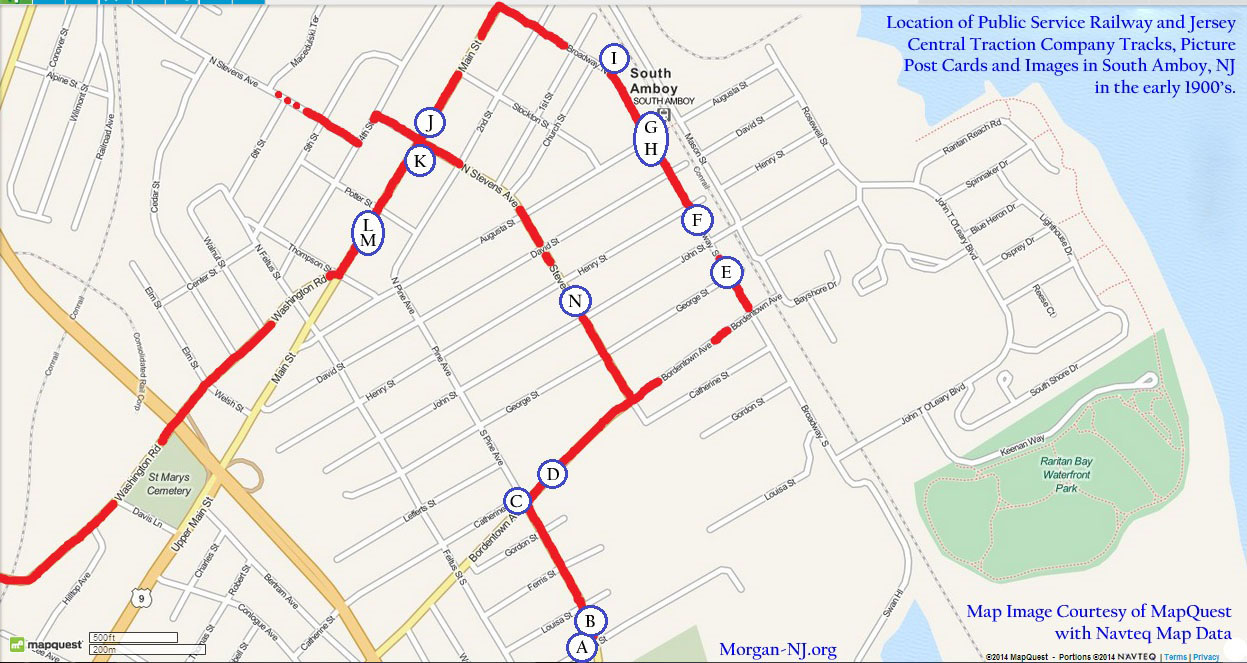
Notated Map of South Amboy, New Jersey Showing Early 20th Century Trolley Routes and the Locations of Where the Below Photographs Containing Trolley Tracks Were Taken.
For its size, in the early 1900’s South Amboy had a lot of railroad tracks running through it. In its railroad heyday, there were three railroads: the Camden & Amboy, the New York & Long Branch Railroad / Central Railroad of New Jersey / Pennsylvania Railroad, the Raritan River Railroad and two trolley lines: the Public Service Railway Company and the Jersey Central Traction Company. Very impressive for a city with an area of just 1.5 square miles!
The purpose of this page is to take old photos of South Amboy from the early 1900’s which had trolley tracks in them and show on a map approximately where these images were taken. Another thank you goes to Joyce Elyea, whose collection of early South Amboy picture post cards and images greatly contributed not only to George Francy’s Images of America South Amboy book and also to this page.
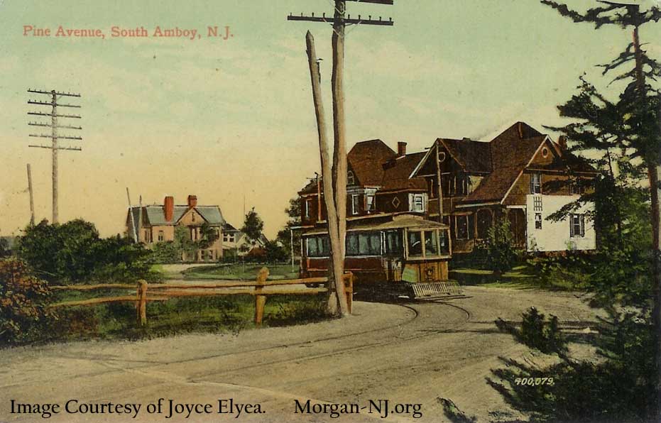
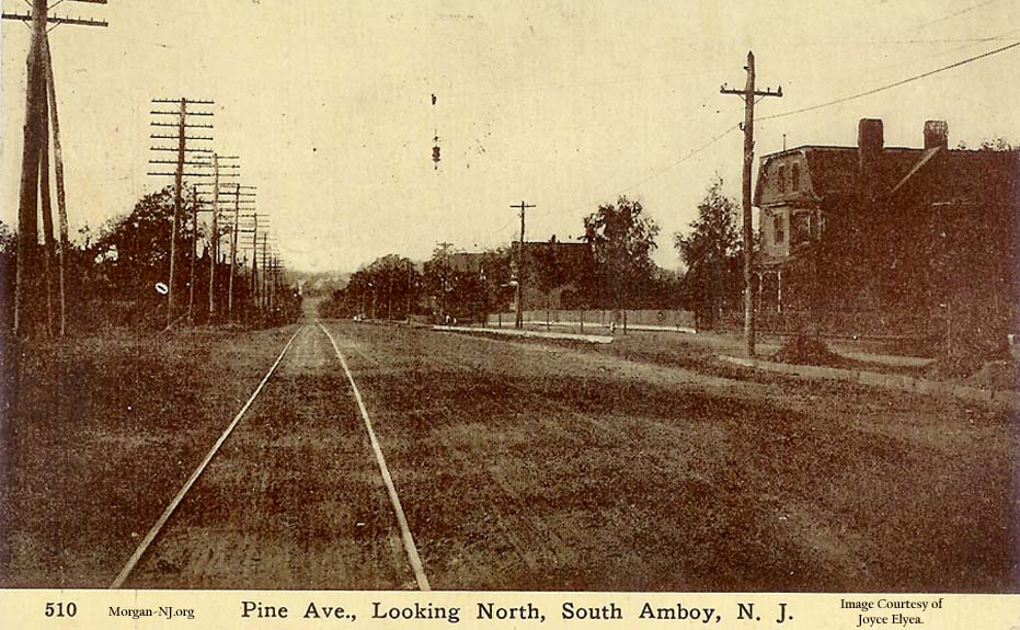
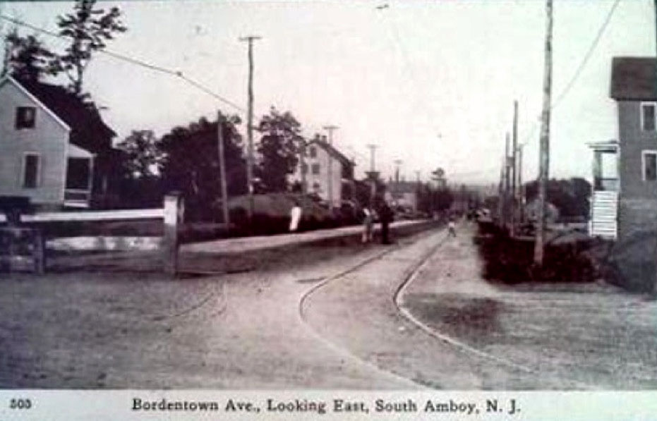
When you look at the various picture post cards, you’ll see that they came from a number of different series published at different times. One of the series, possibly the oldest circa 1900 – 1905, had black and white images with a series number and description written in a white footer area. The roads surrounding the trolley tracks were dirt. There are four from this series on this page (Images B, C, F, & L). The next three series types still have dirt roads but are colorized, probably by hand, either partially in the sky (Images J & N) or fully either somewhat realistically (Images A & M), or seemingly impressionistically (Image H). Image K appears to be part of yet another series because of the coloring type and the series number contained in the text at the top of the card. It is hard to tell if the street is paved in this one but one souvenir left on the road in the image strongly implies it was still the horse and buggy days.
This image will look familiar to the reader as it was used in the Morgan-NJ.org page describing the route of the Public Service Railway from Morgan through South Amboy and Sayreville to New Brunswick. Of the images on this page, this is the one which is furthest south. Guess one could argue that the other images in the other page could have been used in this one as well but that would be too much duplication. The southernmost end of the Public Service Railway line on the eastern part of New Jersey was but a few hundred feet from this location.
Just like the above image, this image was included in the page describing the route of the Public Service Railway from Morgan through South Amboy and Sayreville to New Brunswick. According to Bill Marshall, the house on the right with the flat roof, which still stands today, once belonged to Alfred Kerr who was mayor of South Amboy before 1925.
It took Joyce and me quite a while to determine that this image shows the bend of the Public Service Railway going from Pine Avenue to Bordentown Avenue, right next to present day Jacqueline’s Florist. This image shows only one track going on Bordentown Avenue so it would have to have been taken between 1900, when the trolley line opened up, and 1905 when the Jersey Central Traction Company opened for business on a track which ran right next to this one at this point.
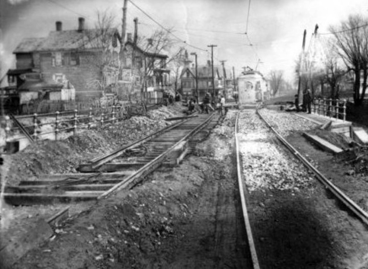
Here we can see both the Public Service Railway track on the left and the Jersey Central Traction Company track on the right. It looks like the Public Service Railway was undergoing some form of construction work. This image was taken just east of the Pine Avenue and Bordentown Avenue intersection. It is hard to recognize the first two buildings on the left, especially since the first one is no longer there. The second one is present day Jacqueline’s Florist though in this image it is pretty unrecognizable. The house which allowed for positive identification of the location of this image is the third one which matches the current house located at the southwest corner of the Pine Avenue and Bordentown Avenue intersection. Wonder what that tower is over this house in the image? You’ll note that having two sets of tracks on this narrow road, which lead to a bridge over the Raritan River Railroad on the way to Stevens Avenue, was a very large problem a few years later when the automobile was becoming the primary method of transportation.
This is the first image in this collection showing Broadway, in this case looking north. The building just to the right of the horse and buggy on the northeast corner of John Street and Bordentown Avenue is still standing. I remember getting coffee ice cream cones there as a kid (though that didn’t translate into being a coffee drinker later in life). At the time this image was taken, the railroad passenger station was located on this side of the tracks right next to this building.
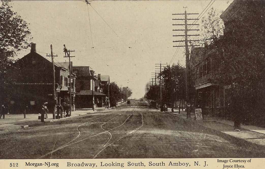
This image is a little further north but looking south. You’ll note that by this time, the tracks were modified to have a passing siding right near the railroad passenger station. Check out the guy on top of the pole on the left! Also note that, as is still true today, the west side of Broadway (the right side in this image) is the side of the street with the majority of the overhead electrical wires.
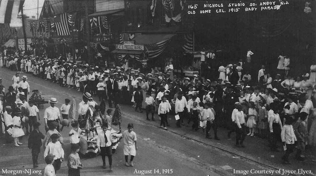
The exact location of this photo was extremely difficult to determine though I now have confidence that it was taken on Broadway just north of the intersection of Broadway and Henry Street and is looking southwest. This image was taken during the Saturday, August 14, 1915 Baby Parade which was one of the activities making up the South Amboy Old Home Celebration of 1915. From what I can tell, the Old Home Celebration was an annual event which occurred for a week each August (Old Home Week) to celebrate South Amboy and its founding, as per Congressman John Scully in the South Amboy Citizen of August 14, 1915, “two hundred and thirty years ago.” The 1915 celebration culminated on Friday and Saturday with the following planned events: Arrival of the US Navy Destroyer McCall which anchored off of the city dock in the channel, Coronation of a Queen, Mardi Gras and Carnival, Baby Parade, Fireman’s Parade, Auto Parade, and Land & Water Sports activities. St. Mary’s also had a picnic on their school grounds on Stevens Avenue which attracted thousands of people.
According to the South Amboy Citizen of August 21, 1915, the Baby Parade formed at John Street, went north on Broadway, turned around at Main Street then went back to John Street. One report indicated the parade was to start at 3:30 in the afternoon. Another report indicated that because there were so many entries in the parade and there were so many people to move out of the way, the start of the parade wasn’t until 4pm. Looking at the image with this time of day info allowed for the determination of which direction the image was facing, i.e., the shadows are on the left side of the people which, in the afternoon, would imply they are facing north. This would mean the photo was taken during the beginning part of the parade and thus the buildings we are looking at are on the west side of the street, south is on the left and north is on the right. Determining where on Broadway was very difficult but when comparing to an image on Google Maps Street View, it seems that the two buildings at the top left (to the right of the sign which says “GS”) are the same two building which are still located at the northwest corner of the intersection of Broadway and Henry Street. The building on the corner has a V shaped roof on the third floor and the building next to it, with the two American flags in the picture, seems to match the current three story building which has a flat roof.
Old Home Celebration doesn’t seem to occur anymore in South Amboy and may have ended sometime in the early 1930s. No doubt there is someone presently in South Amboy who can fill us in about the meaning and history of the Old Home Celebration.
Note that the map shown at the top of this page does not currently correctly show the location of this image. The map was created prior to the realization of the actual location and will be updated at some point in the future.
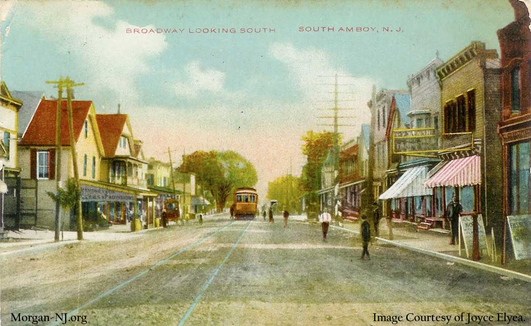
Without some reference points contained in image I below, this nicely painted post card looking south on Broadway was difficult to place. Comparing to recent times via Google Street View isn’t very helpful as many of the buildings are either now gone, replaced or modified enough to be unrecognizable. Comparing to the below image shows a number of similarities though even these aren’t fully conclusive. Firstly, the street feels similar at this location. On the left side of the street, there are a few buildings with V shaped roofs. On the right side, there are a number of flat roofed buildings. The two items which instill the most confidence is the large tree to the left of the trolley in the above image which seems to match the large tree in the image below sans leaves and the two poles on the left side of the street which lean sideways toward the buildings. One additional data point regarding where this might be is contained in the image on the bottom of page 58 of George Francy’s Images of America South Amboy. The left side of that image partially shows what appears to be the same building as is partially seen on the right side of image I above. Therefore, this appears to be north of the intersection of Broadway and Augusta Street but just south of the present day City Hall / Police Department.
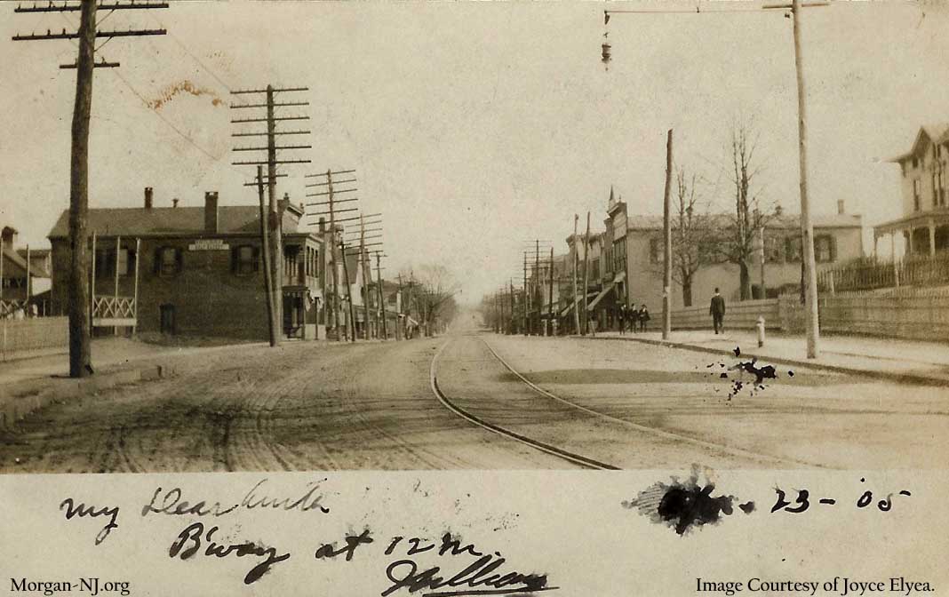
This picture post card, with a hand written date of April 23, 1905, was obviously taken sometime before that. The bend in the road implies that the photo was taken on Broadway in front of the Presbyterian Church which started to be constructed in August, 1866 on land donated by the Camden and Amboy Railroad.
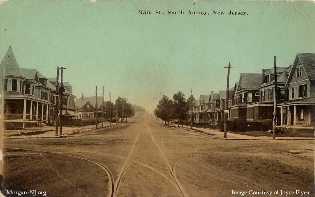
This is the first image showing Main Street. Funny, it never felt like the main street to me, Broadway did. It wasn’t until I started doing this research that I understood why it was named that. This image is looking west toward Stevens Avenue. You’ll note the Jersey Central Traction tracks which split off in both directions on Stevens Avenue. Another landmark to many of us is the house on the corner on the left which is presently the medical office of Dr. Harold McKenna. He is fantastic!
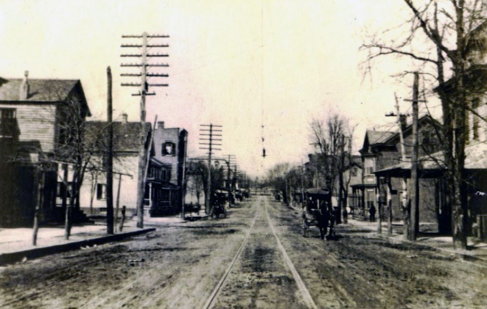
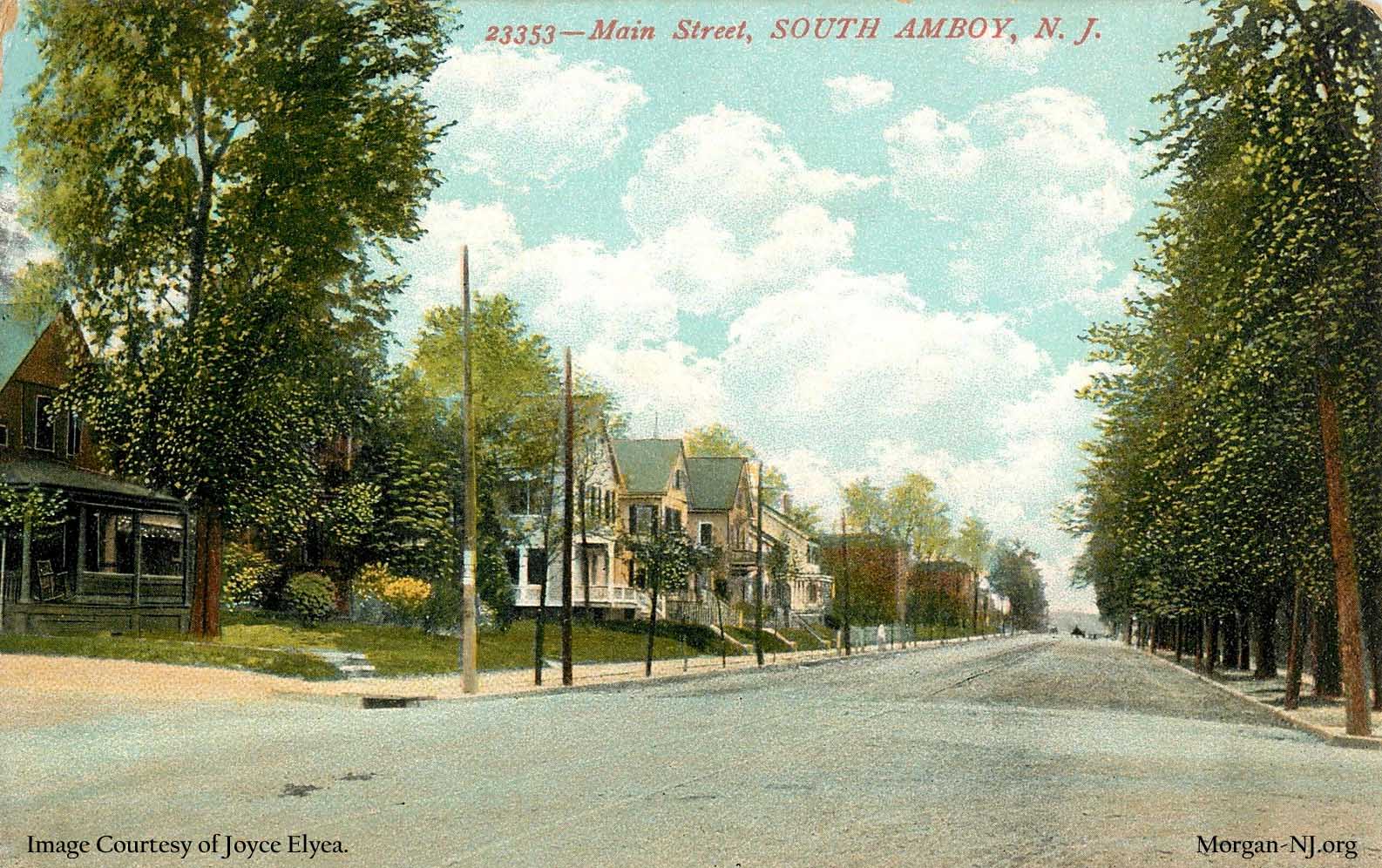
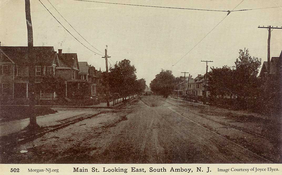
This image is on Main Street but looking the other direction from the other side of the street and in a different year. Note the institutional looking buildings on the left side of the street down the road. George Francy, in his Images of America South Amboy book, seems to indicate that these were affiliated with Christ Church. I believe I read in a back issue of the South Amboy Citizen that the large trees on the right were removed during the Depression as part of a Works Progress Administration work program.
This image is a little further west from the previous one at the intersection of Main Street and Potter Street. The house on the corner on the left is still there today.
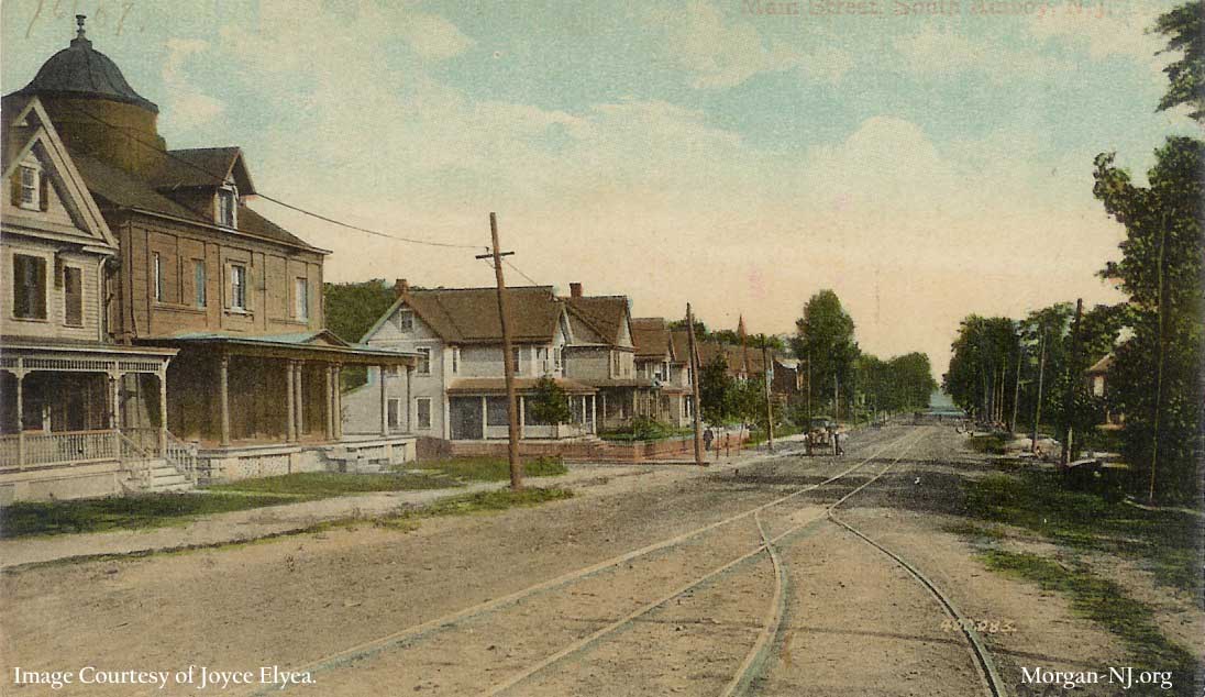
This image is on the other side of Main Street and a little further west still but still looking east on Main Street. The big house with the round cupola is reported to have once been the Stevens Family mansion previously located on the once nearby Stevensdale Estate but later moved to this location. A little known fact of South Amboy history is that Commodore John Cox Stevens was the person that formed the syndicate which in 1851 won the Queens Cup yacht race around the Isle of Wright. The cup was brought to America and renamed to the America’s Cup. The America’s Cup race continues to this day and sports the oldest trophy in international sports. Commodore John Cox Stevens is interned in the crypt under Christ Church, just down the street though not seen in this image.
This is on Stevens Avenue looking north between John Street and Henry Street. None of the buildings in this image, with the exception of the house at the end of the street, are recognizable or perhaps even still standing. If it wasn’t for the images in George Francy’s book, I don’t know that I would have been able to pin point where this image was taken.

Congratulations Verne for a very impressive tour on the screen which I expect will inspire some to revisit it behind the wheel. I reflect on your “very impressive” comment on South Amboy’s rail network for a small town. SA was eager to make itself small, reasoning that the railroad-generated revenue could be better utilized by the town father’s in a tighter area so they were eager to shed Madison Township and Sayreville. They reasoned that “less is more” before Mies made his architectural observation. Or, in otherwords, “the heck with the countryside, we’ll keep the money in town.”
Thanks so much. The institutional looking buildings on Main Street are probably the Christ Church Home for Girls where my mother and her sisters grew up after the death of their mother around 1920. There were about 20 to 30 resident girls there. They attended the public schools and were often supported through post secondary education.
Hello,
I am doing some research on my grandmother who I believe resided at this home along with her sister probably sometime between 1900 – 1920. The story goes that her mother passed away and her father was unable to care for them. My father and grandfather could never get a copy of her birth certificate because they said there was a fire at the home and it destroyed the records. Do you know of such a fire? I do have a copy of her baptismal certficate from Christ Church parish. Would appreciate any details you know of about the home.
The “institutional looking buildings” on the 2253 Main Street postcard were actually an orphanage and a school for the orphans. Children here were taught how to be servants of the rich when they grew up. I love all the photos on your page! I’m not from South Amboy, but have lived here for 9 years and find it to be a town very rich in history!
Hello,
I am doing some research on my grandmother who I believe resided at this home along with her sister probably sometime between 1900 – 1920. The story goes that her mother passed away and her father was unable to care for them. My father and grandfather could never get a copy of her birth certificate because they said there was a fire at the home and it destroyed the records. Do you know of such a fire? I do have a copy of her baptismal certficate from Christ Church parish. Would appreciate any details you know of about the home.
I own a house on Main street in South Amboy and would like to get a few of these photos. How do I find them?
does anyone know the name if the dinner that was on the corner of john st and stevens ave?
I believe it was the Amboy Diner. Although, I am difficulties finding photos of it. I have seen one picture of it of the internet circa 1940s; although can’t exactly place the corner itself. It can only be the two corners with new housing on them. If anybody can direct me to more pictures, I would be grateful
I love history in general but I get a little extra kick learning about the town I live in. Thank You for the time and effort you spent on this page.
Thank you for this wonderful article. You are correct about the picture and postcard showing Broadway looking south toward Augusta. My great grand uncle owned a grocery store pictured there. I had looked for a picture before but never saw it before now.
Awesome, Diana! Got any stories from your great grand uncle you can share here?
What the diner name on John and Stevens was Dillons ??? But not 100% sure —
A very intriguing article thanks for sharing this.